I am having what seems to be an odd behavior on the map display after the transition line from NOAA NAM to GFS.
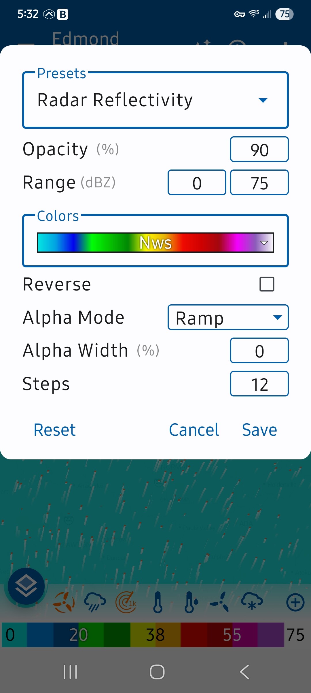
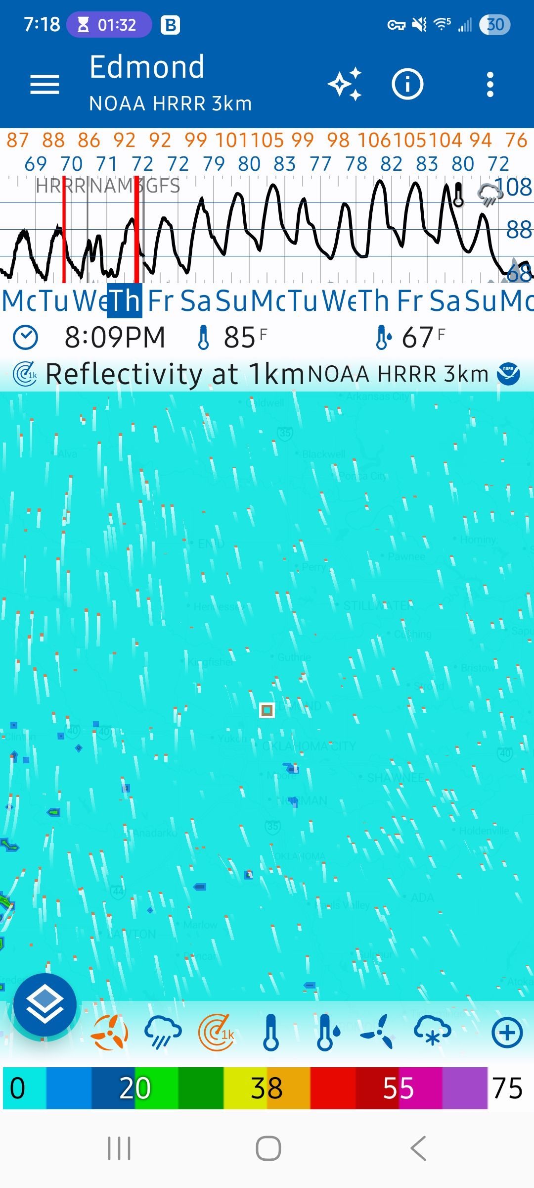
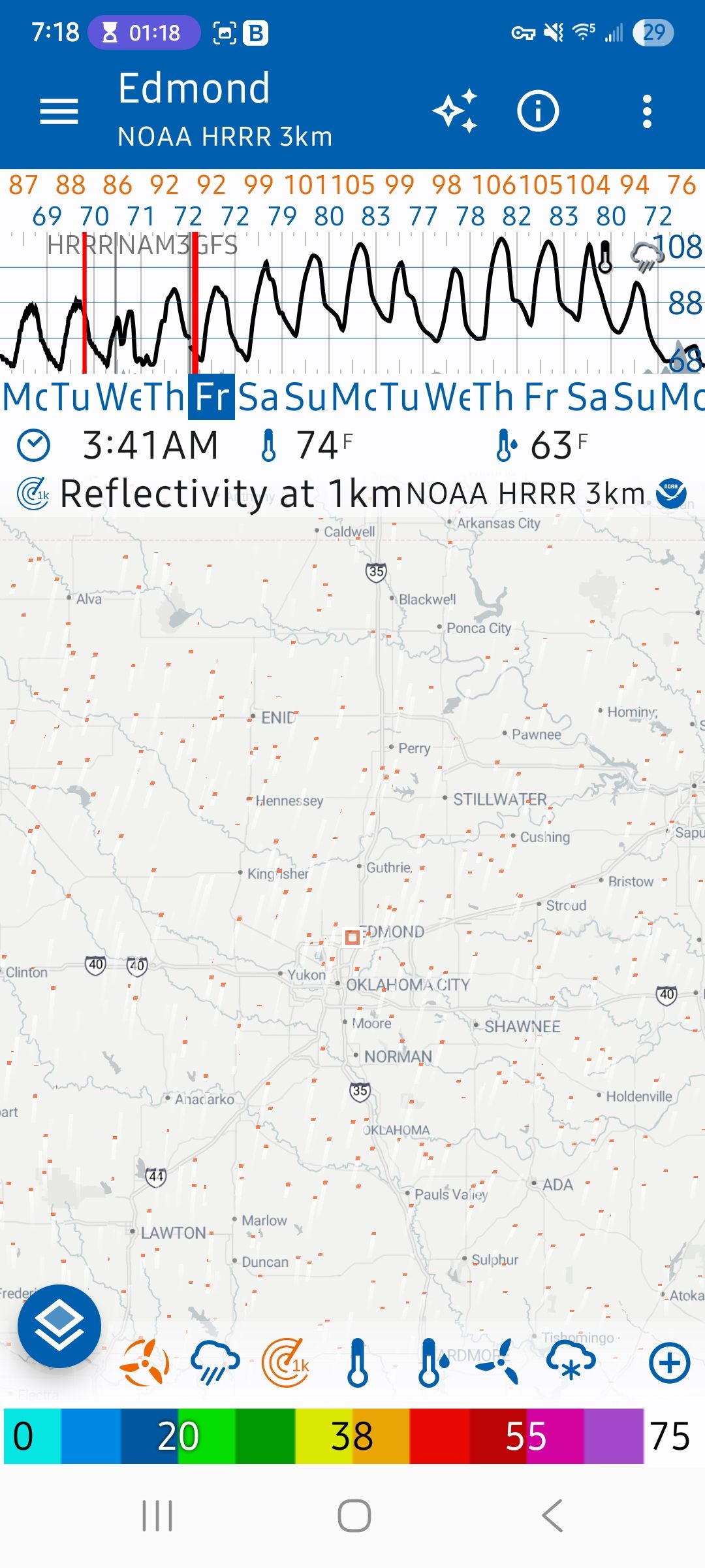
I currently have HRRR selected as the model. At the end of the model output, it transitions to NAM, then to GFS. The attached file ‘PreGFS.jpg’ shows the map display prior to the transition from NAM to GFS. The attached file ‘PostGFS.jpg’ shows the display after transitioning to GFS. I can’t figure out how to make the display show the PostGFS image for the entire timeframe, regardless of the model. I’ve tinkered with the color palettes and the behavior seems related to Alpha Mode and/or Alpha Width. ‘Palettes.jpg’ is the palette in use when the Pre- and PostGFS images were captured.
Thank you.